
US Election Simulator for Milwaukee users
If you follow politics from Milwaukee, Wisconsin, US Election Simulator gives you a hands-on way to study 2026 election maps, test scenarios, compare control odds, track polling context, and explore the state, county, primary, governor, Senate, and House views that make elections worth following.
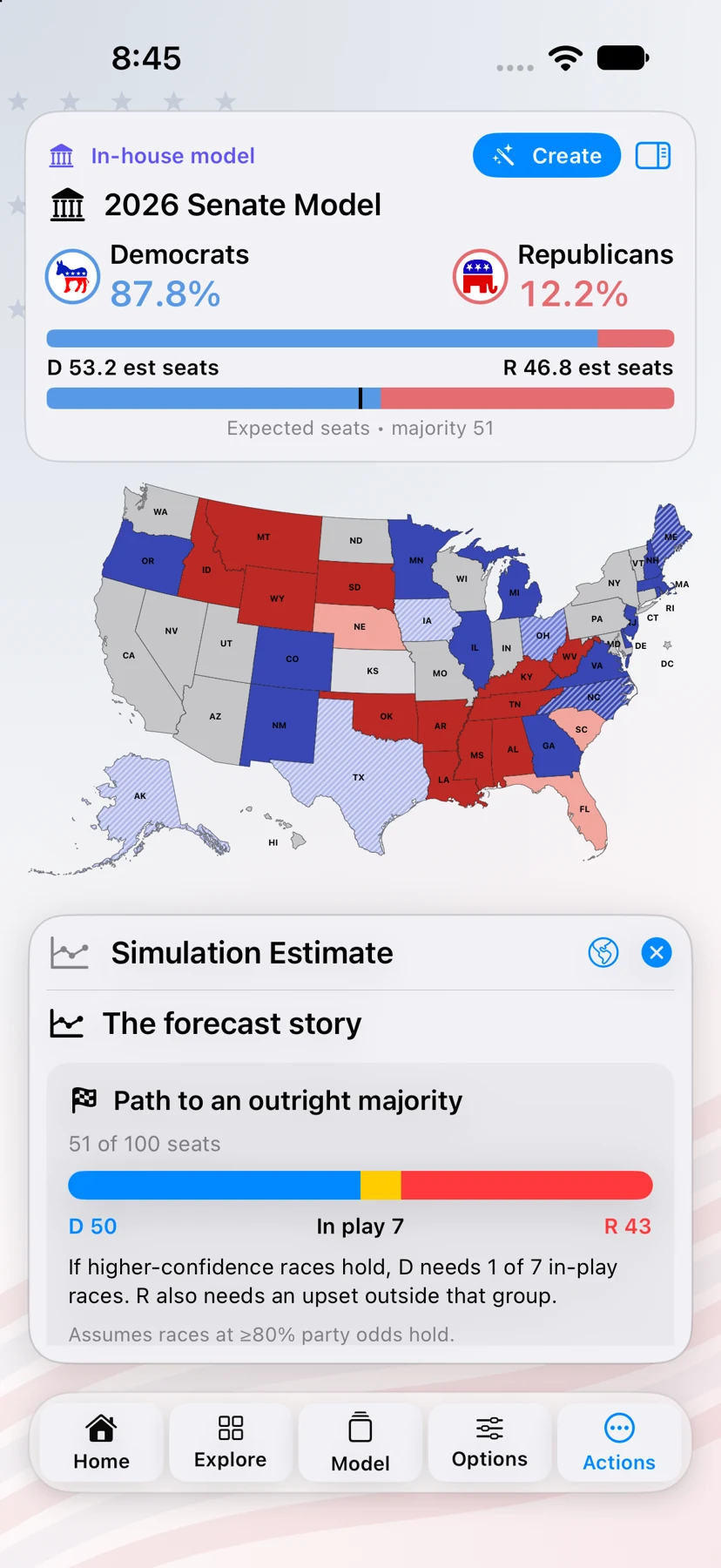
For people who want to understand the map behind the headline.
People in Milwaukee who follow politics often want more than a single forecast number. The app lets you work through the map yourself: compare presidential outcomes, study battleground movement, check chamber control paths, and see how a scenario changes when one race or state shifts.
Instead of bouncing between articles, social posts, polling tables, and cable-news graphics, you can use one app to move from the national picture to the local details that explain the result.
- Check the race for 270 and compare presidential maps quickly.
- Explore 2026 Senate, House, and governor maps with toss-up and party-count views.
- Use Senate, House, and Governors model screens to test control odds and seat paths.
- Review Daily Summary, Daily Odds, race headlines, polling context, and approval tracking.
- Create shareable map cards for messages, social posts, and your own analysis.
Maps for the whole race
Explore President, History, 2026 Senate, 2026 House, 2026 Governors, Democratic primary, and Republican primary screens from one election workspace.
Models and odds
Explore Senate, House, and Governors models, candidate win odds, vote estimates, and forecast charts. Create and share a personal model with a guided setup.
Election Night Live
Follow reported Senate, House, and Governors results, check poll-closing times, and compare saved predictions with called races. Share your score and present the map in TV mode.
Useful before the race, during it, and after the votes are in.
Use the app before a debate to preview scenarios, during a campaign to follow polling and odds, and after results come in to revisit counties, margins, and state-by-state movement. Recent iPad and iPhone improvements make the deep feature set easier to navigate with organized menus, compact research panels, and refined portrait and landscape layouts.
- Organized Explore navigation and screen-specific Options and Actions
- Readable bottom-menu tools for screens, scenarios, maps, and options
- Optimized iPad portrait and landscape layouts
- Static map elements designed to reduce accidental changes while exploring
Why might someone in Milwaukee use it?
Because political coverage becomes more useful when you can test the map yourself. You can compare assumptions, follow control paths, and decide which outcomes look plausible.
Is it only for election experts?
No. It is approachable for curious voters, but deep enough for people who regularly follow polling, margins, county shifts, and model movement.
What makes it different?
It combines maps, models, primaries, governors, polling, odds, daily analysis, shareable cards, and election-night scenario tools in one iPhone and iPad app.
Live coverage varies by provider and race. Model probabilities are simulations; illustrative vote totals use historical turnout assumptions.